FIND MY PAGE ON FACEBOOK!!!!!!
The Weather Dork
  • Home
  • Educational Blogs

A New England Volcano?

4/3/2019

 
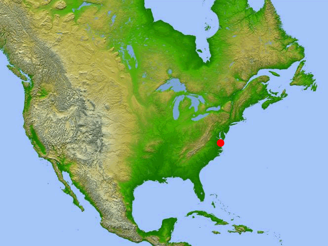
There's a mass of warm rock beneath central Vermont, western New Hampshire, and western Massachusetts and it's on the move.

One of the ways that geologist visualize what the inside of the Earth looks like is by using sound. Much like an ultrasound is used to look at a baby in the womb we can use seismic waves from earthquakes to see what the inside of the Earth looks like. By seeing how long it takes for a sound wave to make it to another location on the surface of the Earth we can deduce what type of material it's moving through in the asthenosphere. The asthenosphere is one of the layers inside of the Earth as depicted in the following image...
Picture
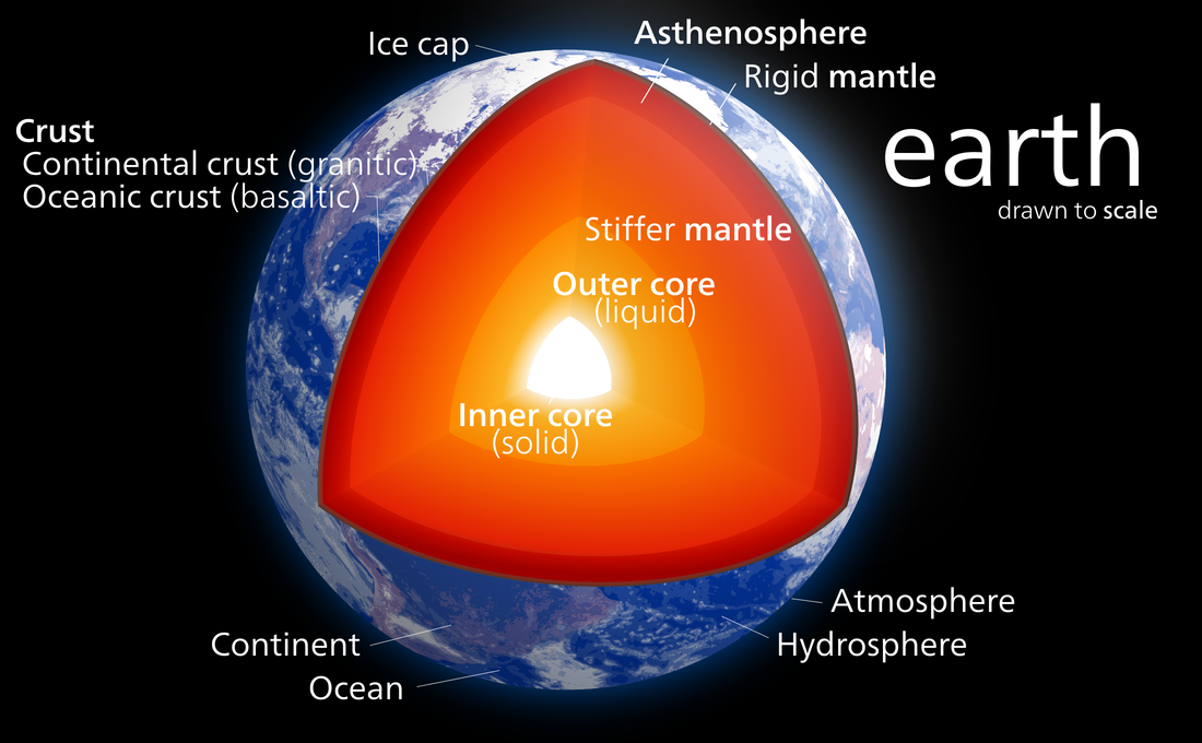
Layers of the Earth from Wikimedia Commons
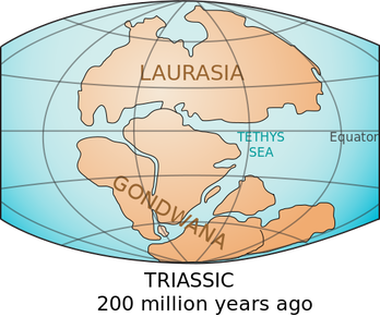
Now, I'll give you a little bit of a backstory: the last time that the northeast of the United States was geologically active was around 200 million years ago when the supercontinent of Pangaea broke apart. Yes, there's been some evidence that there may have been a hotspot, much like what is forming Hawaii, that developed beneath the North American plate but that's not what this post is about. This is about the future.

Anyway, after many years of research that involved testing the arrival of sound waves from earthquakes around the world, an anomaly was discovered in New England. Basically, the sound waves are depicting a mass of warmer rock rising up through the mantle. Now, eventually, this mass could make it to the surface and develop a new volcano in New England. Maybe not.
Picture
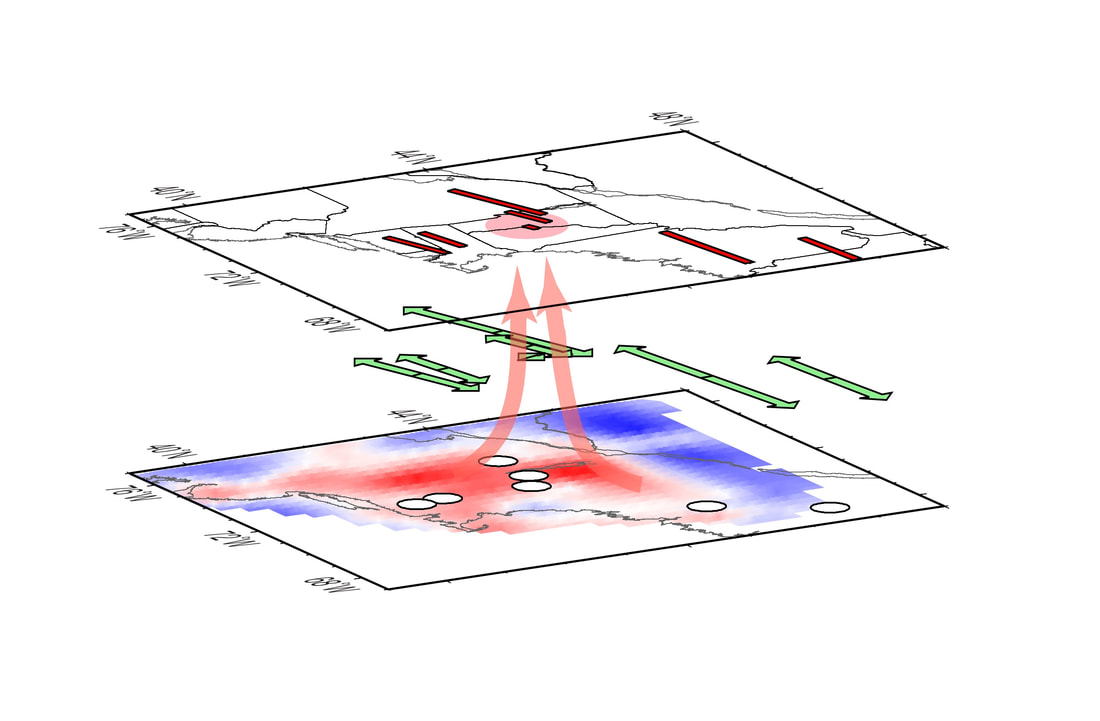
Graphic of mass of warm rock upwelling underneath New England. Image: Rutgers.edu
Much like our knowledge of the oceans, we know very little about the interior of the Earth. We have a basic understanding of plate tectonics, which is the process that involves large chunks of the surface of the Earth moving around. This is how features like the Mariana Trench, the Himalayan Mountains, and Alaskan and west coast volcanoes formed. The problem is, the northeast of the United States is in the middle of the North American Plate. When you're in the middle of a plate, it's not supposed to be geologically active. That's why this is such a confusing discovery to some geologists.

I've read some articles saying that this new mass of magma may eventually form a new supervolcano in the northeast and I just don't believe it. The author of the study that discovered this mass of warmer rock said very clearly in his report that this is not magma. Therefore, I don't even know if this is going to create a new volcano let alone a supervolcano. But what I do know is that it's going to take tens of millions of years for really anything to happen. In fact, it'll probably take at least 50 million years for any noticeable change on the surface. By then, New England is going to look very different because of erosion and whatever else the depths of geological time have in store for us.

So sleep well tonight knowing that if you live in the northeast of the United States you're safe from underground volcanoes. I'll be sure to give you a heads up if anything changes in our lifetime.

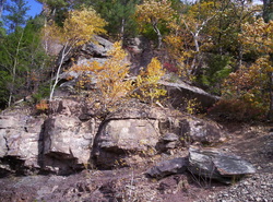
P.S. If you do want to see mountain building action, look no further than the Adirondacks. They are, in fact, still growing in height. They are very geologically different and very geologically separate from the Appalachian mountains, including the Catskills. I'll have another post on that sometime soon.

Sources:
https://pubs.geoscienceworld.org/gsa/geology/article-abstract/doi/10.1130/G39641.1/522870/seismic-evidence-for-a-recently-formed-mantle?redirectedFrom=fulltext

https://www.scientificamerican.com/article/new-england-is-sitting-on-a-bed-of-hot-rocks/

The Birth of the Himalayan Mountains

5/2/2015

 
Picture
The Himalayan Mountains by Himanshu Punetha. Creative Commons. http://goo.gl/3zR8CG
If you liked my page in the past year or so you missed out on my educational blogs that I used to write quite regularly.  My job has been an outlet for my nerdiness so my brain is usually tired when it comes time to write a blog about some incredible topic related to Earth Science.  When I call myself a dork I am serious.  I believe “nerd” and “dork” are terms of endearment that someone earns.  Perhaps I am justifying my own lifestyle but nothing is more exciting to me than knowledge.  Hence this page and this blog.

Anyway, I have been wanting to write this blog entry for about a year now.  The horrendous and devastating 7.8m earthquake that took place in Nepal on April 25 killed at least 6,000 people (as of 5/1/15) increased my conviction to share with you the geology of Nepal.  This part of the world is one of the most geologically active regions on Earth.  The reason for activity is actually an intriguing piece of geologic history and an excellent example of the power of plate tectonics.

About 225 millions years ago what is now India was actually a large island hanging out in what is today the south Indian Ocean near Australia.  This body of water between India and what is now Asia was called the Tethys Sea.
Picture
The Tethys Sea and India by LennyWikidata. Creative Commons. http://goo.gl/zKnPXi
Pangea, the last supercontinent (all of the continents clumped together) began to break apart.  It was at this time that India began drifting north toward Asia.  At first the movement was not too fast but soon the Indian plate would pick up speed and end up being one of the fastest-moving tectonic plates in the world.  The entire chunk of land began “flying” northward at a rate of about 6’’ per year.  That is very fast for geologic processes.  In fact, this movement to the north happened so fast that there still skidmarks on the bottom of the Indian Ocean from the edges of India being pushed northward.  Really these skidmarks are ancient volcanoes formed from a “hot spot” that pushed magma to the surface as the Indian plate moved northward.  This is the same process that is forming the Hawaiian Islands.
Picture
Notice the "skidmarks" south of India on the ocean floor. Image by Uwe Dedering. Creative Commons. http://goo.gl/vRzBft
PictureThe movement of India. Public Domain. http://goo.gl/EiylZ
So, here we go.  Around 50 million years ago India closed the Tethys Sea and slammed into Asia.  The science of plate tectonics, or the movement of the Earth’s crust, is essentially the study of what happens when an immovable objects meets an unstoppable force.   The Indian Plate is made of continental crust.  The Asian plate where India collided is also continental crust.  This means that rock that makes up both plates is similar in the sense that it is less dense than its counterpart, oceanic crust. 

Think of it like this:  you are swimming in a pool with one of those nice floating air mattresses floating at the surface.  You are not paying attention to where you are swimming.  Ahead of you is the air mattress pushed up against the wall of the pool.  You keep swimming and suddenly you hit the air mattress.  What happens?  You go under it.  Why?  The air mattress is more buoyant than you and can float on top.  This is what happens on the surface of the Earth.  The plates that make up the crust float on top of magma but sometimes those plates collide much like you do when you hit an air mattress.  The air mattress is the continental crust.  You are the ocean crust (more dense).  You go under the air mattress just like the oceanic crust goes under the continental crust (called subduction).  

So now take out the air mattress and put in someone of your similar weight and size.  You swim toward one another, collide, what happens?  Well yes, it hurts, but figuring out who goes under and who floats over the other person is not so easy because of similar density.  This is what happened with India hit Asia.  India began to crumple and fold on the northern edge as it pushed into the continent.  Yea, you crumple a piece of paper and the result is not too impressive.  Now crumple continent and watch what happens.  Those ridges end up being thousands of feet tall.  The crumples and folds gave birth to the Himalayan Mountains.  The most famous mountain that almost everyone knows is Mt. Everest.  Everest is 29,035 tall.  That is nuts.  That is where planes fly.  There are nine other peaks above about 26,000 feet in the Himalayas.  The next tallest mountain outside of Asia is found in South America (called Aconcagua) and it is ONLY 22,841 feet tall.  Such an underachiever, right?

Picture
Animation showing the collision of India with Asia. Image by Raynaldi rji. Creative Commons. http://goo.gl/injGSN
PictureMap of the Himalayas. Public Domain. http://goo.gl/PPT4hJ
India is still pushing into Asia.  Rock does not like being pushed around.  The result of this colossal fist fight between these two chunks of rocks is earthquakes.  Where two pieces of the Earth’s crust meet there are hundreds of small earthquakes every day.  Unfortunately these tiny earthquakes cannot release all of the stress and occasionally there is a large crack or snap.  The 7.8M earthquake in Nepal is an example of one of these large cracks or snaps.

So let us consider the Himalayas for a moment.  Remember when I mentioned that the Tethys Sea closed due to the Indian Plate moving northward?  Well before it closed all of those fish and critters floating around lived and died just like all animals today.  When critters die in the ocean they sometimes sink and can potentially become fossils.  The land that was at the bottom of the Tethys Sea was in a badddd place.  It was pushed under Asia until India collided and finally some of it was pushed into the Himalayan Mountains.  From there the only place to go is up.  Today we can find fossils of fish and whales many thousands of feet up in the Himalayas.  

Anyway, the Himalayas are growing at a rate of about a centimeter a year.  If you do the math over all of those millions of years you would probably come to the conclusion that the mountain range should be hundreds of miles high.  Well, you are correct, but Earth’s atmosphere is sassy.  There is a reason people do not live on the tallest mountains.  It is NOT VERY FUN AT THE TOP.  You cannot breathe because the air is so thin.  The wind blows your face off.  Radiation increases at higher altitudes.  All of these processes are not fun for humans and they are definitely not very kind to rock.  It is called erosion and it is the great equalizer of land.  As the mountains grow, they erode, and this prevents Mt. Everest from reaching into the orbit of the International Space Station.  

Also, if you get really large you run the risk of breaking the chair you are sitting in.  The rock under the Himalayas is only so strong and definitely cannot support a 200 mile tall mountain very well.  The rock would crack and fold and landslides would prevent much vertical growth.

The reality is that humans are just a species living on a planet that frankly does not care that we are here.  Species rise and fall all of the time and we are just along for the ride.  Earthquakes and other natural disasters will continue.  The only thing we can do is gain knowledge and try to make people aware of the risks of living in areas where Earth’s crust collides.  

Thanks for reading!

Here are some facts:
  • The Appalachian Mountains were once very similar to the height of the Himalayas about 300 million years ago.  300 million years of erosion fixed that.
  • The Himalaya vertical growth is slowing.  This is probably because India is spreading out rather than pushing north as much as it used to.
  • The Himalayas will erode to nothing one day.
  • People are obsessed with climbing Everest.  Around 4,000 people have made it to the summit since the first in 1950. About 250 people died trying to reach the summit and many of those people are still frozen on the mountain.
  • The Adirondack Mountains are growing, too!  If the Himalayas grow about 3 feet every 100 years the Adirondacks grow about 6’’ to 1’ every 100 years.  This rate exceeds the rate of erosion.  Earthquakes are common in the Adirondacks.

I do not know everything.  Here are my sources:
http://www.todayifoundout.com/index.php/2013/12/himalayas-formed/
http://www.wisegeek.org/how-were-the-himalayas-created.htm
http://pubs.usgs.gov/gip/dynamic/himalaya.html
http://scienceline.ucsb.edu/getkey.php?key=3907
http://www.geolsoc.org.uk/Plate-Tectonics/Chap3-Plate-Margins/Convergent/Continental-Collision
http://www.telegraph.co.uk/news/worldnews/asia/mounteverest/10774877/Climbing-Mount-Everest-what-you-need-to-know.html


Tornadoes in New YOrk

7/9/2014

 
I've received multiple messages on my page on facebook over the past 24-48 hours about what is going on with the weather.  Many see the severe storms lately as being unusual, especially those with tornadoes.  

While it may seem like there has been many tornadoes and much severe weather as of late it is actually not unusual.  

For example, in 1989 a tornado outbreak put down 4 tornadoes in New York and around 16 in the entire northeast.  

How about a short article about the "Great Windfall of 1845" from the Adirondacks:  http://goo.gl/0yXnWc

and

I made a blog post about a gigantic tornado that struck Poughkeepsie, NY back in the late 1700s: http://goo.gl/D9vY0n

and 

Here's an article about a terrible tornado in 1856 in northern NY: http://goo.gl/RqUzHp

and 

Here's another article from the New York Times about a "terrific" tornado that struck Poughkeepsie in 1863: http://goo.gl/oQbH9j

From 1953 until 2013 there were 411 tornadoes in New York State with 26 deaths.  Most of these tornadoes took place in central NY and the Hudson Valley; however, the tornadoes occurred in each geographical region of the state.  A mountain may hinder a tornado, but it will not stop it all the time.  In May of 1952 an F2 tornado struck just southwest of Whiteface Mountain in the Adirondacks.  Whiteface is over 4,500 feet tall.  

Lowville, NY was just hit with a tornado on Tuesday.  The town is no stranger to tornadoes.  In 1987 an F0 struck the town (I remember seeing a mountainside with a streak of trees broken for years) while just a couple dozen miles to the west and south there have been F1 to F3 tornadoes.  

I strongly suggest checking out http://www.tornadohistoryproject.com/tornado/New-York/map to learn more about these tornado statistics in New York State.

Remember, technology and media have both grown over the past 50 years.  A small tornado in the middle of nowhere may not have been reported in the early 1900s but today our radars and satellites can see anything anywhere.  The media loves to talk about tornadoes hitting places where you may think "tornadoes can't happen" but please understand that tornadoes can happen ANYWHERE.  

So, as far as tornadoes are concerned, this is unfortunately relatively normal.

Earth's bully

4/10/2014

 
About 3.26 billion years ago there were no animals as we know them today.  There were no dinosaurs.  There were no fish.  Basically, there was some land, lots of water, and lots of bacteria floating around in that water.  Earth was formed only 1.34 billion years before this, and evolution takes time, so the bacteria were doing a pretty good job at evolving into what would become multicellular life (but that was going to take more than another billion years).  

Anyway, all the bacteria were floating around in the water when something pretty serious occurred. 

A massive asteroid measuring about 36 miles across smashed into the young Earth.  We've known for a while that this happened but we didn't know how bad it was.  Geologists, geophysicists, and other awesome intellectuals have done some outstanding research into the event.  We now know what happened when this asteroid struck the Earth. 
Picture
The impact wasn't this big. I use public domain images. It gives you an idea, though.
The impactor was the size of Rhode Island and four or five times larger than the asteroid that is believed to have wiped out the dinosaurs.  It was moving about 12 miles per second (over 40,000 mph).  

When you take something that big and smash it into_ something else, it hurts.  Earth didn't like it.  The impact was so great that the ENTIRE earth experienced a quake of about 10.8 on the Richter Scale.  This earthquake caused more earthquakes and in all, the Earth shook for about a half hour.  Mountains literally collapsed.  

Remember all that water I was talking about?  Yep, you guessed it, tsunamis were everywhere.  In fact, it's projected the tsunamis were up to 3,000 feet high. 

As with most asteroid strikes, a bunch of red hot Earth was thrown into the atmosphere that eventually scorched the surface of the Earth.  Oceans boiled (well at least the tops boiled), the sky turned to fumes, and everything was just not very nice.

But some pretty amazing things happened when this asteroid (and other struck the Earth).  No one really knows how or why Earth ended up with tectonic plates that slide under, over, and past each other. Some geologists believe that impacts like the one I just discussed essentially started the process of plate tectonics on Earth.  Think about that.  Giant rocks smashing Earth eventually caused the crust to fracture enough to become massive islands.  These islands float around and collide on top of an ocean of magma. Pretty cool.  

Furthermore, and this is conjecture but I'm certain many would agree, this impact probably changed the course of evolution.  How?  I'm not sure.  Maybe we would have twelve fingers instead of ten if the asteroid did not hit.  That's the beauty of it!  Every little thing in history shaped who we are today.  Again, pretty cool. 

Anyway, thanks for reading.  

Here are some sources: 
http://blogs.kqed.org/science/2014/04/10/new-study-examines-geologic-impact-of-a-massive-asteroid-collision-on-ancient-earth/

http://geosociety.wordpress.com/2013/04/28/when-did-plate-tectonics-begin-on-earth-and-what-came-before/

The Chesapeake Crater

1/29/2014

 
The largest crater in the United States can be found in the Chesapeake Bay.  Roughly 35 million years ago the Appalachian Mountains were covered in tropical rainforests.  Little critters wandered about when a mile-wide rock or chunk of ice traveling at supersonic speed crashed into the Atlantic Ocean off of North America.  Ocean water and rocks were thrown 30 miles into the sky.  Everything within a few hundred miles of impact on the East Coast was incinerated.  The force of the impact spawned tsunamis hundreds of feet tall that smashed into Blue Ridge Mountains (maybe the tsunamis were even taller than the Blue Ridge Mountains).  When all was settled, a 56-mile-wide crater formed in the floor of the Northern Atlantic Ocean.  
Picture
Location of the Chesapeake crater. Image: Creative Commons- Author Unknown as of 1/29/14
Scientists believe that this asteroid or comet impact, along with others, largely contributed to the Oligocene extinction, which severely affected land mammals.  

The extinction is believed to have been caused by climate change.  Records show that temperatures were relatively warm around 35 million years ago.  Based on geologic data, it is believed that between 36 and 34 million years ago a comet/asteroid shower occurred on Earth.  Suddenly around 34 million years ago records indicate the Earth cooled rapidly.  By 33.4 million years ago the Oligocene extinction took place.  Scientists theorize that the multiple impacts of asteroids and comets caused prolonged darkness, wildfires, and acid rain.  These events led to the mass extinction and the rapid cooling.  
Picture
Boundaries of the Chesapeake Crater. Image: Public Domain
Now back to the Chesapeake Bay Crater.  Recently, scientists drilling over a mile down into the crater discovered something absolutely astounding.  The drill poked into a pocket of water deep in the Earth.  This is not just any water, this water is 100 to 145 MILLION years old.  It is trapped over a mile underground in an area of about 60 square miles.  

The water was in the sediment long before the impact occurred and was trapped by folding and faulting that took place when North America broke away from Europe.  The impact of the object only stirred the water but did not allow it to seep out.  The water is very salty- twice as salty as modern seawater.  The problem with this is that the aquifers for groundwater in the area are highly susceptible to contamination by this extremely salty groundwater just below.  With such a large population to support, this is concerning.  
Picture
Profile of the Chesapeake Crater. Image: Public Domain.
The crater itself also has dramatic impacts (no pun intended); local rivers and even the Chesapeake Bay are severely influenced by the crater.  The depression of the crust of the Earth due to the crater predetermined the course of rivers and the location of the Chesapeake Bay.  In addition, the crater is contributing to the sinking of land near the Bay.  The coast is literally slipping into the crater.  

The importance of this discovery of this water cannot be underestimated.  The analysis of the ancient seawater will provide insight into the evolution of life.  In addition, it will help scientists understand how salty ancient seawater was to gauge the threat of modern ocean acidification.  Moreover, it is really cool.  

Thanks for reading.  


Sources:
https://www.uwgb.edu/dutchs/EarthSC102Notes/102PTEarthHist.htm
http://www.nature.com/nature/journal/v503/n7475/full/nature12714.html
http://news.nationalgeographic.com/news/2001/11/1113_chesapeakcrater_2.html

Hudson river...canyon? 

12/1/2013

 
Picture
What's the jagged line coming from New York City past the continental shelf? Why does it say Hudson Valley?!
I want everyone to look at the above image from Google Earth.   Years ago when I first used Google Earth I noticed this line cut into the seabed, but it originated in New York City.   Then I began the research and visits to geology professors at my University to find out what exactly I was seeing.  The answer is that this is the Hudson Shelf Valley, the Hudson Canyon, and the extension of the Hudson Valley.  It's comparable to that of the Grand Canyon in the western United States. It is a submarine canyon that begins near the mouth of the present-day Hudson River and extends over FOUR HUNDRED (400) miles into the Atlantic! 

Why don't people know about this?  Because it's been underwater for a long time.  In fact, it's been underwater for over 10,000 years.  

During the Pleistocene Era the sea level was around 400 feet lower than it is today.  The reduced sea level meant that the Hudson River flowed about 100 miles farther to the southeast of where it ends today.  The river discharged sediments and cut out the canyon, much like it does today in the Hudson Valley.   From there, the Hudson carved out a canyon underwater that extends 450 miles to the edge of the continental shelf of North America.   Where the canyon meets the continental shelf, there is an abrupt 2-3+ mile drop in elevation.  
Picture
Underwater topography. Image courtesy of Hudson Canyon 2002, NOAA/OER.
The walls of the canyon range from 15-30 yards tall to about 3/4 of a mile tall at the continental shelf.

So can you just get in a submarine and travel down the "Hudson River" in the Atlantic?  Not really.  Years ago New York City used to throw all garbage into the Hudson; as a result, the garbage piled into the canyon.   

Of course, why does any of this matter?  Well first, it's really cool.  Second, submarine canyons are potentially very dangerous.  Because of the temperatures and pressures maintained in their depths, submarine canyons are known to contain pockets of methane hydrates.  In fact there might be enough methane in the Hudson Canyon to power the United States for centuries.  However, methane hydrates are unpredictable and if the gas is able to escape, it can cause massive turbulence on the ocean floor sometimes leading or triggering large earthquakes.  In 1929 an earthquake measuring 7.2M occurred on the edge of the Grand Banks to the east of Nova Scotia.  This earthquake was believed by some scientists to be caused by an underwater rock slide possibly caused by methane deposits shifting.  A tsunami formed.  This tsunami was anywhere between 10-25 feet tall though in narrow bays the wave was nearly 90 feet tall.  Around 28 people died and the earthquake severely damaged underwater communication lines.  

This could happen in the Hudson Canyon even without methane.  An underwater rock slide causing a massive shift in a column of water could lead to a large tsunami/earthquake on the east coast.  In addition, the Hudson Canyon is a path for most trans-Atlantic cables from and to the United States.  Communications, including Internet, would be severely hindered by an underwater disaster in this area.  

For now, it's pretty cool to look at and think about.  

Thanks for reading.  

Sources: 
http://fopnews.wordpress.com/2010/01/29/off-new-york-citys-deep-end-a-pleistocene-grand-canyon/
http://oceanexplorer.noaa.gov/explorations/02hudson/welcome.html
http://www.whoi.edu/main/news-releases/1995-2004?tid=3622&cid=2078

Ghost lights in the Catskills and Hudson Valley

10/31/2013

0 Comments

 
Picture
When history and folklore cross paths, extraordinary and exceptional stories result.  In general, this murky area between history and the stories people tell is where you can find the most unusual hauntings.  Investigating each region individually, the Hudson Valley and Catskills each possess their own unique hauntings; however, one particular form of haunting seems to be consistent across much of the region: Will o' the Wisp, or, ghost lights.

This particular story will focus on the Devil’s Kitchen region in the Catskills of New York.  The region holds claim to multiple reports of ghost lights.  Devil’s Kitchen is located off of Platte Clove Road in west Saugerties, NY.   

Many names of places in the Catskills contain the name of the Devil.  There are plenty of stories about the various cloves in the mountains that were created by the Devil.  Devil’s Kitchen got its name from the various shaped boulders at the bottom of the gorge.  People believed that these boulders were the kitchenware of the Devil; in addition, during storms settlers could hear banging as if someone was cooking in a kitchen in the mountains.  These sounds were most likely caused by boulders falling down into Platte Clove.  Regardless, the stories kept people out of the mountains at night, particularly in the Platte Clove area near Devil’s Kitchen.  

Off of Platte Clove Road bluestone was quarried for building multiple structures in the Hudson Valley.  These bluestone quarries can be found abandoned across the entire Catskill Mountain region; however, one abandoned quarry is particular interesting due to its unusual characteristic- people often see ghost lights in this area.  The origin is uncertain, however, many people believe that these lights are from miners that died while mining the bluestone in Devil’s Kitchen.    

PicturePlatte Clove Road
There is a small campsite at the top of the cliffs above Devil’s Kitchen.  This campsite is frequented by kids that live in West Saugerties looking to sneak away into the woods.  I have never been to the campsite personally, however, a friend from high school did frequent the campsite and told me of a story that happened to him and three others.  

It was late September and the four boys hiked down the path leading to the campsite above Devil’s Kitchen.  My friend told me that the path was littered with downed trees and bushes that prevented a steady pace.  At the campsite, they boys made a fire and began cooking dinner.  Soon after dinner while the boys were talking around the fire, they began to hear moaning and whispers in the trees around them.  At first they believed the wind and trees were creaking and moaning but to make sure they grabbed flashlights and began walking around the area to see if anyone was nearby.  They walked down the path that led to and from the campsite.  When they came around a corner they saw a light floating in the path about 40 feet in front of them. The boys called out to whoever it was standing on the trail.  There was no response.  Another light appeared behind the first and slowly floated toward the closest.  (Mind you this path is full of trees and there is no way to hold a lantern steady while negotiating the trail.)  The boys called out again but there was no sound.  They put their flashlights together to try to see as far down the path as possible but there was no figure or person, just a light among the downed trees. 

PictureCliffs near Devil's Kitchen
The light disappeared.  At this point the boys went back to the camp to pack up to leave; however, when they got back to the camp and were putting out the fire they could hear the voices and rustling in the woods all around them.  While walking as fast as they could down the path to get back to their cars they could see lights in the woods around them.  Finally they made it down the trail and cliffs and went home.  
Oddly enough while researching the history and stories behind this story, I came across a post on a website about these ghost lights at Devil’s Kitchen.  Was it my friend posting it?  I cannot tell because I do not talk to him anymore.  Here is the link to this story.

Years later while attending college at SUNY New Paltz I was able to see lights floating on the Shawangunk hills and cliffs.  I always questioned whether these lights could be flashlights from hikers, but I was many miles away and a flashlight would not be visible.  Of course, some I could dismiss as car lights shining across the valley.  However, there were others that seemed to float up and down as if they were separated from the ground itself.  They would only last for a few seconds, but long enough to make you wonder what it was you were seeing.  

In Highland, NY I used to have a view of Illinois Mountain from my bedroom window.  I was facing the west, so I could see storms coming over the mountain and into the valley near the Hudson River.  It was at these stormy times that I would see lights floating among the trees and over the canopy on the mountain.  There is a slight possibility that these lights could have been ball lightning; however, this phenomena is extremely rare and I saw the lights on the mountain at least four times over a five year period.   

Now, barring any explained phenomena (lightning, gas, flares), what could be causing these ghost lights?  There are many explanations of the lights.  Some believe they are the spirits of Native Americans walking down old paths in the woods while holding torches.  Others believe these lights are alien spacecraft landing in the woods.  Others believe the lights are simply the spirits of the dead that are damned to roam the Earth for eternity.  What do you think?  

Picture"Will-o'-the-Wisp by Arnold Böcklin
I implore you, while driving down lonely mountain roads at night, heighten your awareness and keep an eye out for the specter lights that haunt the Hudson Valley and Catskill Mountains.  

So, I have to ask, have YOU ever seen lights that you cannot explain?  I’d love to hear your stories in the comments below or on The Weather Dork Facebook page.  

(Below find a news report from North Carolina of ghost lights seen on a mountain in that region.  Ghost lights are common in many places on Earth!) 

For more reading about Will o' the Wisp visit this link. 
Happy Halloween!  Thanks for reading!

0 Comments

The Saturn Superstorm

4/30/2013

 
We should start at the beginning of this story and that means we need to go back 30 years.  One of NASA’s Voyager missions imaged Saturn as it passed the ringed planet on its way to the edge of the solar system.  Anyway, Voyager saw something at the north pole of Saturn that indicated a hexagonal (6 sided) wind pattern much like the polar jet streams here on Earth.  Scientists thought it strange to see such a wind pattern at the North Pole but Voyager was just visiting on its way to the edge of the solar system.  The story jumps forward to just sixteen years ago when a 2.2 million pound Titan IVB/ Centaur rocket took off from Cape Canaveral Air Force Station in Florida.  The rocket traveled 2.2 billion miles to reach its destination- Saturn.  On June 30, 2004 the rocket deployed part of its cargo- the Cassini Orbiter.  The other piece of cargo, the Huygens probe, deployed to the Saturn moon Titan and landed on January 14, 2005. 

The mission for Cassini is simple: explore the Saturn System.  The first leg of the mission was completed in June of 2008.  The second leg, the Cassini Equinox Mission, was completed in September 2010.  The third leg is scheduled to last until September 2017. 

Cassini contains 12 instruments to send daily measurements of Saturn’s system.  Among these instruments is a high resolution imager.  Here is where it gets interesting (if you are thus far bored with AWESOME NASA STUFF!): Cassini arrived, as I said, in 2004.  At this time Saturn was in the middle of its north polar winter.  This means that the infrared imager on the spacecraft could see a giant vortex at the pole but the visible-light view was unattainable until August of 2009.  Sunlight reached the northern hemisphere of Saturn and Cassini’s orbit had to be adjusted to be able to see the poles. 

Picture
False color image of the massive storm. Image- NASA/JPL-Caltech/Space Science Institute
The result is this- the Saturn Hurricane.  This storm’s eye is roughly 1,250 miles wide, which is around 20 times larger than the average hurricane on Earth.    Winds are estimated to be around 330mph on the edge of the hurricane which is 650 miles beyond the edge of the eye. Winds in the eye wall are four times faster than hurricanes here on Earth.   The eye has very little clouds.  The eye wall has high clouds.  The high clouds outside of the eye wall are spinning counter-clockwise like they do in the northern hemisphere of Earth.  It’s a pretty amazing thing. 
Picture
The eye of the massive storm. Image- NASA/JPL-Caltech/Space Science Institute
The question is, how in the world, or rather how in the Saturn, did this giant storm form on a planet with hardly any water at all? 

Hurricanes on Earth form from water vapor.  The warm oceans feed a hurricane’s strength.  The warmer the water the stronger the storm can be.  Bottom line is that we thought that it takes a lot of water for a hurricane to form.  On Saturn, there’s not much water at all.  

Scientists believe that the storm is sustaining itself through the small amount of water available in the atmosphere of Saturn.  Studying the hurricane on Saturn may help us to understand how hurricanes work here on Earth.  Maybe hurricanes don’t need as much water as previously thought to develop into monsters?  Definitely question scientists will investigate in the future. 

The location of the hurricane on Saturn is interesting.  Usually on Earth hurricanes drift to the north and dissipate as they reach colder water.  This storm on Saturn is stuck at the North Pole.  It literally can’t go anywhere else on the planet because of the air patterns. 

So how long has it been there?  Voyager saw something that looked odd 30 years ago.  Cassini spotted a giant swirl at the North Pole in 2004.  Obviously the storm has been there for quite some time and it will probably be there for some time to come.  The good news is that Cassini is going to live and die in the Saturn system and will send measurements and pictures for years to come; however, Cassini can’t just hit the brakes and change its orbit.  Scientists have to plan orbit changes with the gravitational pull of Saturn’s moon Titan.  This requires careful planning years ahead of time to get it right.  NASA is awesome. 

Here is a video of the hurricane on Saturn that you should really check out: 
Anyway, I really hope you enjoyed reading this and have come to appreciate the brilliant things human beings are capable of.   Space is really darn cool and we’re just beginning to understand its secrets.  100 years ago we thought the moon was the next frontier.  Today our technology is venturing out of the solar system.  Imagine where we will be in 100 years!

Sources:
Images-
NASA/JPL-Caltech/SSI
Content-
http://saturn.jpl.nasa.gov/news/newsreleases/newsrelease20130429/
http://news.cnet.com/8301-17938_105-57582182-1/gawk-at-new-images-of-saturns-super-sized-hurricane/
http://saturn.jpl.nasa.gov/mission/quickfacts/

Ten Billion Year Old Supernova

4/4/2013

 
Picture
--------"X-ray, Optical & Infrared Composite of Kepler's Supernova Remnant"-------- On October 9, 1604, sky watchers -- including astronomer Johannes Kepler, spotted a "new star" in the western sky, rivaling the brilliance of nearby planets. "Kepler's supernova" was the last exploding supernova seen in our Milky Way galaxy. Observers used only their eyes to study it, because the telescope had not yet been invented. Now, astronomers have utilized NASA's three Great Observatories to analyze the supernova remnant in infrared, optical and X-ray light. Image: Public Domain- http://en.wikipedia.org/wiki/File:Keplers_supernova.jpg
Ten billion years ago a star in our distant universe reached the end of its life.  It burned all of its hydrogen fuel and worked its way through the elements trying to gasp for some sort "air" to save it from its certain doom.

When all the elements were used up it tried to fuse one last element- iron.  

Iron is stubborn and does not permit fusion.  Well, it does, but it doesn't produce much energy at all.

The problem with this is that as the star was fusing different elements it became larger and larger and much more massive.  More mass = more gravity.  More gravity = more energy needed to maintain size.  Not enough energy to maintain size = implosion.  The implosion is called a supernova.  Think about it- there is no outward pressure preventing the inward pressure from winning.  

This is where it gets really interesting.  

After the supernova most stars turn into an unimaginably dense star called a neutron star.  These neutron stars are many times smaller than the original star that blew up.  The process of collapsing takes roughly 10-20 seconds.  So much energy is produced in the implosion that the dying star outshines its ENTIRE GALAXY for a period of time.  Eventually the supernova (over many many years) dissipates and the neutron star fades into a cold darkness.

Now after the supernova occurs and the star implodes on itself there is another option.  If the resulting neutron star is large enough it will undergo a terrifying and dramatic transformation.  Sometimes the pressure of the implosion on the neutron star is too much for the unimaginably dense star to handle.  In fact, nothing can handle the gravity created by some collapsing stars.  

You know where this is going.  No force can stop the implosion and the light from the star disappears into its collapsing core.  All matter disappears into the its collapsing core.  EVERYTHING disappears into its collapsing core.  A black hole is born.  

So back to the star that tried to fuse iron 10 billion years ago.  It fused the iron, it blew up in a massive light show, and, well, the rest of the story is unknown.  What is amazing about this is that we are JUST seeing the light from this supernova.  Why? Because we are 10 billion light years away from the star that blew up.  

Now it gets sad, because even though we are seeing the light right now, we are seeing something that happened 10 billion years ago.  It is all but guaranteed that the supernova is gone, the star is either a cold dead neutron star or a black hole sitting in space waiting for anything.

Then again, if we were at the location of the star looking back at Earth, our star would not even be here, let alone us.  

There is a happy ending here.  You, yes you reading this, would not exist unless the stars in the universe die.  They release the elements necessary for life and your body contains massive amounts of stardust.  We were all given the building blocks of life because a star died.  

Anyway, if you want to read more about this 10 billion year old supernova check out this link and thanks for reading:  http://www.space.com/20509-most-distant-supernova-found.html?cmpid=514630"

Sources:
http://imagine.gsfc.nasa.gov/docs/science/know_l2/supernovae.html
http://www.universetoday.com/33454/how-do-black-holes-form/
http://www.space.com/20509-most-distant-supernova-found.html?cmpid=514630

The B-52 Crash on Elephant Mountain

1/15/2013

 
On January 24, 1963 high temperatures in the northern woods of Maine only reached the mid teens below zero with a strong wind blowing over the snow covered mountains. 

Many hundreds of miles south, at Westover Air Force Base in Massachusetts, there were nine members of the Air Force sitting for a 6 hour long briefing about the flight plan for that day.  The plan was to fly a B-52C Stratofortress, an $8 million aircraft, through mountainous terrain to test low level navigation to avoid the newest Soviet radar technology.  The plane was to return to Westover at 5:30 p.m.

A B-52C Stratofortress has a wingspan of 185 feet and measures 160 feet from nose to tail. The 8 jet engines can propel this aircraft at speeds of up to 650 mph at altitudes above 50,000 feet.  The plane has the ability to carry two nuclear warheads and a number of short-range missiles.

For this mission there would be no warheads on board. 

The men had a choice: they could fly through the mountains of northern Maine or they could fly through the mountains of the Carolinas.  They chose to fly north into Maine. 

Once in position the crew would simulate entering enemy airspace below radar and travel as close to the ground as possible over and in between the mountains of northern Maine. 
Picture
B-52C Stratofortress -- Image via: http://amilitaryaircraft.blogspot.com
At 2:30 p.m the Stratofortress descended to 500 feet above the surface of the Earth.  They were traveling at about 320mph with the outside temperature at -14 degrees Fahrenheit and winds were gusting at 50mph.

In mountainous terrain something called Lee Waves or “mountain waves” form due to the shape of the Earth.  Just think of it as driving a car over a hilly road.  You go up and down and the entire time it is a turbulent ride.  Now think of a 50mph wind moving across mountains.  It goes up and down and creates dangerous air patterns for those trying to fly near the ground. 
Picture
Lee Waves created as wind moves over mountainous terrain. -- Image via: Wikimedia
The B-52 encountered turbulence within minutes of reaching the 500’ altitude.  The crew commander ordered the pilot, Lt. Col. Dante E. Bulli, to climb above the turbulence.  As the plane began its ascent a loud noise, similar to an explosion, was heard.  Bulli began to lose control of the aircraft immediately after the loud noise.  The plane turned to the right 40 degrees and the nose was pointing down at the ground.  Bulli tried to regain control of the plane but the controls were not responding to his commands.  Realizing they only had a few moments before crashing, Bulli ordered the crew to abandon the aircraft. 

The upper deck of a B-52 is the only location that has upward launching ejection seats that can function at any altitude.  The pilot, copilot, and navigator are on the upper deck.  The lower deck has downward launching ejection seats and therefore an altitude of 200 feet is necessary to allow for ejection- otherwise the seats would crash into the ground and guarantee death.  Spare crew members do not have ejection seats and must use parachutes and jump out of the doors of the plane. 

The navigator, Capt. Gerald J. Adler, ejected first.  He was followed by the pilot, Lt. Col. Dante E. Bulli.  The copilot, Maj. Robert J. Morrison, was the third to eject. 

The plane was in a steep dive and the altitude was below 200 feet.  The lower deck members had no way of ejecting from the aircraft.  Within seconds of Morrison ejecting the plane smashed into the side of Elephant Mountain at 2:52 p.m at over 300mph. 

The remaining crew on the B-52 died immediately.  They were:
Lt. Col. Joe R. Simpson Jr.
Maj. William W. Gabriel
Maj. Robert J, Hill
Capt. Herbert L. Hansen
Capt, Charles G. Leuchter
T-Sgt. Michael F. O’Keffe

Only two of the three parachutes deployed and the wind buffeted their descent to the ground.  Morrison’s chute deployed and he ended up a mile away from the crash site.  Upon reaching the forest his seat crashed into a tree and killed him.

Lt. Col. Bulli broke his ankle when he landed in a tree 30 feet above the ground.  His chute deployed. 

Capt. Adler’s chute did not deploy and he landed in 5 feet of snow about 2,000 feet from the crash site. He struck the ground with an impact equal to 16 times the force of gravity.  The collision fractured his skull and snapped three of his ribs.  The impact was so hard that it bent his ejection seat and he could not access his survival kit. 

A logging road worker saw the final turn of the B-52 and witnessed the fireball and smoke after it crashed into the ground.  He contacted the authorities immediately. 
Picture
Location of Elephant Mountain in Maine. -- Image via: Google Earth
Picture
Elephant Mountain -- Image via: http://wilsonpondcamps.com
A team of 80 rescuers made up of the Maine State Police, Fish and Game Department, Civil Air Patrol, Air Force, and volunteers rushed to locate the wreckage before nightfall which was less than two hours after the time of the crash.  They did not reach the crash site in time and had to wait until first light to continue the search. 

Bulli and Adler were alone and did not know if there were any other survivors.  Temperatures dropped rapidly after sunset through the -20’s to around -30 degrees Fahrenheit.  Bulli was able to access his survival kit and removed the sleeping bag to cover himself in his perch 30 feet above the ground.  Again, Adler’s seat was bent and he could not access his sleeping bag.  He opened up his parachute and used it as a blanket to survive the night.   

The next morning the Scott Paper Company sent plows to clear the logging road near Elephant Mountain.  They had to pile the snow over 10 feet high to create a path wide enough for emergency vehicles to respond.  The plows were only able to get the responders within 1.5 miles of the crash site.  Fortunately they brought snow machines to travel the rest of the way. 

By mid-morning the rescuers had reached the crash site.  They had to search the surrounding woods for survivors as they did not know how many ejected before it crashed.  Finally they found Adler and Bulli and at 11 a.m on January 25, 1964 they were airlifted to a hospital. 

Bulli spent three months in the hospital and returned to active duty upon his release.

Adler lost consciousness for five days and developed pneumonia.  His leg was so badly frostbitten that they had to amputate it when gangrene set in.  He spent the better part of a year in the hospital but did survive. 

Aftermath:

An investigation was conducted and it was determined that turbulence-induced structural failure was to blame.  Due to buffeting stresses from the “mountain waves” the B-52’s vertical stabilizer broke off of the plane.  This was the loud bang the crew heard.  It landed a mile and a half away from the impact site.  With the vertical stabilizer gone the plane lost all directional capability and rolled uncontrollably before crashing into the mountainside. 

The B-52 was not engineered for making quick maneuvers at an altitude of 500 feet.  This was not recognized until three more B-52s suffered stabilizer failure over the next year killing 5 men.  Finally Boeing decided to strengthen the rudder connection bolts.  Immediately the “problem” was fixed. 

Authorities removed the classified and top secret wreckage from the impact site but it was not logical to remove all of the wreckage from the mountain.  Today you can visit Elephant Mountain by accessing a 400 yard trail off a logging road north of Greenville, Maine. 

In the Fall of 2011 Bruce Reed, a Maine Forest Service employee, found an ejection seat while hunting on Elephant Mountain.  In May of 2012 Reed returned and documented the numbers on the seat to see if it was a match with the B-52.  It matched and was removed and placed in a memorial for the crash victims created by the Moosehead Rider’s Snowmobile Club. 
Picture
The Elephant Mountain B-52 Memorial -- Image Via: Wikimedia
I ventured to the crash site with my father in 2001 when I was 14 years old.  The wreckage is scattered across the side of Elephant Mountain as far as the eye can see.  Massive tires, panels, wires, and a large chuck of fuselage litter the mountainside.  The attached video is from the camcorder we used to record the hike 12 years ago.  There are some shots of our dog at the time; however, I want you all to see the vastness of the wreckage in the woods:
Fifty years ago next week the B-52 crashed on the mountainside.  It is a haunting endeavor to head miles into the woods, away from all civilization, and to find the remains of the aircraft as if the accident happened a few months ago.  We cannot forget the seven men that lost their lives in this plane crash nor can we forget the story of their sacrifice. 

Thank you for reading.


Sources:

http://www.mewreckchasers.com/B52C.html

http://www.ejection-history.org.uk/aircraft_by_type/b52_stratofortress.htm

http://www.foxnews.com/us/2012/05/22/seat-from-163-b-f2-crash-reportedly-found-in-maine/

http://www.moosehead.net/history/B-52.html

<<Previous

    Author

    I am an educator and avid student of Earth sciences and history. 

    Archives

    April 2019
    May 2015
    July 2014
    April 2014
    January 2014
    December 2013
    October 2013
    April 2013
    January 2013
    December 2012
    November 2012
    October 2012
    September 2012
    July 2012
    June 2012
    April 2012
    March 2012
    February 2012
    January 2012

    Categories

    All
    Asteroid
    Astronomy
    Cme
    Earth
    Flare
    Geology
    Ghost
    Global Warming
    Great New York Flood
    Halloween
    Hurricanes
    Ice Dam
    Little Ice Age
    New England
    Northeast
    Optics
    Sun
    Universe
    Volcanoes
    Weather

    RSS Feed

Powered by Create your own unique website with customizable templates.